
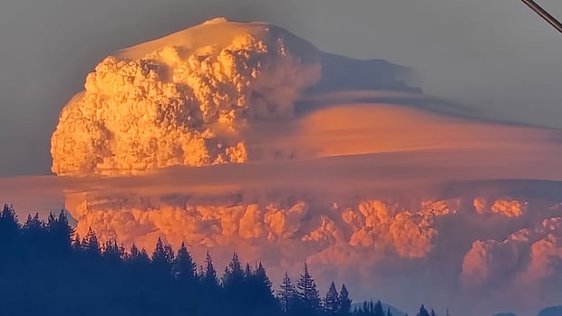
A massive blaze in the southwest region of France has resulted in the formation of the nation’s inaugural documented pyrocumulonimbus fire cloud. Such unique cloud formations are typically observed during extensive wildfires and have previously been documented in Canada during wildfire seasons, including the recent instance during the Boston Bar fire in British Columbia.
Pyrocumulonimbus clouds, known as pyroCb clouds, are characterized as immense and resembling cauliflower, visible from distances exceeding 200 kilometers. These clouds often loom above dense smoke plumes, resembling the dark, fluffy cumulonimbus thunderstorm clouds from which they derive their name, with “pyro” signifying fire.
Initially appearing as smaller pyrocumulus clouds reaching up to five kilometers in altitude, these clouds can escalate into pyroCb formations, extending over a dozen kilometers above ground level when fueled by substantial wildfires. A notable “monster pyroCb” in British Columbia in June 2021, monitored by NASA, propelled smoke up to 16 kilometers high, covering an area exceeding 160,000 square kilometers.
The formation of fire clouds is triggered by the heat from wildfires causing upward drafts of hot air that carry moisture, smoke, and burning embers. As the atmosphere cools at higher altitudes, the vapor and smoke condense, creating a cloud above the smoke column. While pyrocumulonimbus clouds are infrequent in Europe, they can appear abundantly during North American wildfires, as noted by NASA.
Meteorologist Mike Fromm from the Naval Research Lab in Washington, D.C., pointed out that Canada experiences a high occurrence of pyrocumulonimbus clouds compared to other regions worldwide. These fire clouds can exhibit thunderstorm-like behavior, generating strong winds, lightning, and downdrafts when they reach significant sizes. Despite darkening the sky and hindering visibility for firefighters, these clouds produce minimal rainfall due to smoke particles limiting water droplet size.
The dangers associated with pyrocumulonimbus clouds include the potential for erratic winds, lightning strikes, and the creation of nighttime-like conditions during the day. These clouds can trigger lightning-induced fires in new areas, intensifying the unpredictability and hazardous nature of wildfires. Additionally, the dispersal of ash and smoke by pyroCb clouds into the lower stratosphere can transport these particles globally, remaining in the atmosphere for extended periods.